Southeastern Everglades Ecosystem Monitoring Program
In the southeastern Everglades, widespread changes including hypersalinity, marine transgression, reduced macrophyte productivity, and expansion of degraded habitat known as the “white zone” have occurred over the last 50 years. Modified freshwater delivery due to water management and background sea-level rise are attributed (Ross et al. 2000). In Taylor Slough, water management has altered the timing and duration of flooding resulting in the conversion of areas of open water slough to short hydroperiod marsh. Our goal is to understand how changes in quantity, timing and quality of water deliveries will affect Taylor Slough, downstream wetlands and the Florida Bay estuary.…Read more about this project
Mangrove Experimental Manipulation Exercise (MEME) Project
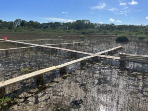
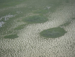
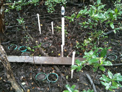
The Model Lands project is in the Southern Glades Wildlife and Environmental Area immediately north of the C111 canal and to the west of US 1. The project is focused on wetland adaptation to stressors such as climate change and sea level rise. 72 1m by 1m plots will be used to test a variety of responses including soil elevation change via sediment elevation rods (SETs), nutrient levels in both water and soil, biogeochemical processes, periphyton response, and above- and below-ground biomass. The experimental design will test the ability of a coastal wetland to outpace sea level rise through positive soil elevation change and productivity. The overarching hypothesis is that the addition of sediment and phosphorus will confer the greatest wetland adaptive capacity in a marl coastal marsh. The experiment will also aid in elucidating environmental factors that can hinder positive soil elevation change as well as determine the best methodologies for enhancing coastal wetland productivity..…Read more about this project
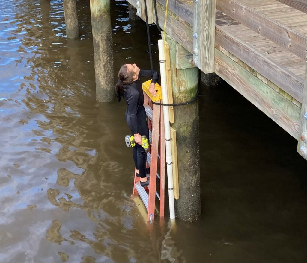
Coral Gables Tidal and Mangrove Sediment Elevation Study
Coastal wetlands provide essential direct livelihood services to millions of people, as well as critical regulating services such as maintenance of water quality, protection from storms and erosion, and carbon sequestration. Measuring the vertical movement of the coastal wetland surface and its constituent processes, and relative local sea-level rise (SLR) is necessary to determine whether a wetland can keep pace with SLR.
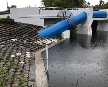
Tidal data can assist in understanding localized flooding associated with king tide flooding and sea-level rise. These data are an important resource for hurricane preparations and for recreational use about boat clearance through rivers and canals.
Four monitoring stations are being established: 2 tidal stations at Blue Road and Isla Dorada Boulevard bridges and 2 tidal and soil elevation monitoring sites in Matheson Hammock and a mangrove site near Coral Gables Marina.…Read more about this project
SECOORA Partnership Project: Southeast Water Level Network
In partnership with the Southeast Coastal Ocean Observing Regional Association (SECOORA) and other research partners, we are contributing to a network of water level sensors deployed across the Southeastern Region of the United States. The data collected by this network is providing real time observations of water level fluctuations, along with a wealth of other water parameters. Work from this project is helping city emergency management and planners address resilience concerns across the region. The City of Coral Gables hosts a Smart City Hub and applies these water level data to understand flooding risks in emergency planning and operations. Check out the SECOORA data portal here and FIU sensor data.
Mangrove forests cover 1% of the continental surface but represent large C stocks (eg. Micronesian forest 400-1400 Mg C ha-1; Kauffman et al. 2011) due to large belowground C stocks. Respiration flux from belowground, as CO2 to the atmosphere or as dissolved aqueous CO2, is a key component of coastal C cycling. Variation in soil respiration fluxes can be a function of numerous physical and biological factors including temperature, root production, benthic microalgae, invertebrates, duration and frequency of inundation, salinity, alkalinity and nutrient availability. Our goal is to quantify soil CO2 flux rates and patterns of aqueous pCO2 as a function of inter- and intra-site variability to elucidate key factors controlling soil respiration fluxes and losses of mangrove forest C.…Read more about this project
Current Sea Level Solutions Center Projects
The Resilient305 Collaborative is a joint academic-government research partnership among Florida International University (FIU), Miami-Dade College (MDC), University of Miami (UM), and government and non-government organization (NGO) leaders of the Greater Miami Beach Area. The Collaborative is piloting a research strategy, focused on an area of GM&B dubbed the “Little River to North Beach Resilience District.” This diverse area constitutes of communities with varying degrees of exposure to natural hazards, socioeconomic conditions, and technological capacities. The Collaborative began in 2016 as an outcome of the MetroLab Network and was created to work together in support of comprehensive resilience research and learning. Within the universities, the team includes faculty across disciplines of physical, environmental, and social sciences, including public and mental health, information technology, communications, disaster risk management, engineering, architecture, planning, and education.
The citizen science project, Shading Dade, attempts to answer the question of “How hot is it really in Miami?” Since 2018, FIU’s Sea Level Solutions Center in partnership with Catalyst Miami have partnered up to launch this event. Students, faculty and citizen scientists deploy tiny heat sensing iButtons around Miami-Dade county in areas where residents are likely to congregate (ex: bus stops, public parks and more). The sensors are deployed in both full and open canopy areas in order to compare the difference in temperatures. There are also sensors that only monitor humidity as well. Every neighborhood has different environmental characteristics that contribute to how residents experience temperature. This event helps us monitor extreme heat in the county, raising awareness about climate stressors that will affect our communities. To date, we have had 8 deployments of these sensors!
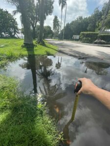
This citizen science event attempts to answer the question of how sea level rise will affect South Florida. Since 2015, the FIU Sea Level Solutions Center in partnership with the FIU Department of Journalism and Media have recruited citizens and scientists to document the extent of flooding during King tide events – the highest high tides of the year. During the sampling, participants measure water depth of flooded areas and various water quality parameters, including salinity, nutrient content, and the presence of E. coli – a common harmful bacteria that affects human health. Photos are taken along the way to document the sampling process. The amount of floodwater in the streets has varied from year to year with a high of more than 2 feet in some neighborhoods. We just had our 8th Annual Sea Level Solutions Day this past October!