Southeastern Everglades Ecosystem Monitoring Program

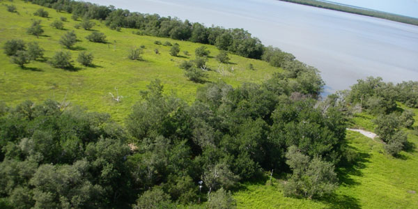
Location of Alligator Creek sampling station west of Taylor Slough
Background
In the southeastern Everglades, widespread changes including hypersalinity, marine transgression, reduced macrophyte productivity, and expansion of degraded habitat known as the “white zone” have occurred over the last 50 years. Modified freshwater delivery due to water management and background sea-level rise are attributed to these landscape changes (Ross et al. 2000). In Taylor Slough, water management has altered the timing and duration of flooding resulting in the conversion of areas of open water slough to short hydroperiod marsh.
Research Objectives
Our goal is to understand how changes in quantity, timing and quality of water deliveries will affect Taylor Slough, downstream wetlands and the Florida Bay estuary.
We accomplish this by measuring nutrient, hydrologic and biological parameters in a spatially extensive network of sites in the southeastern Everglades ecotone, along Taylor Slough, and throughout the C-111 Spreader Canal Project footprint encompassing the Model Lands, C-111 Basin and Lower Taylor Slough.
Study Area
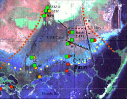
Taylor Slough from the S332D control structure south to Taylor River, west of Taylor River in Alligator and McCormick Creeks and east of Taylor Slough in the C-lll or southeastern Everglades Panhandle.
 Study area and sampling locations. Circles and green boxes mark locations of hydrology/water quality stations and macrophyte plots, respectively. Taylor Slough sites are differentiated from other project sites by orange circles. C-111, Alligator Creek (AC), McCormick Creek (MC), and Model Lands sites are marked in red. The Model Lands site is east of US Hwy 1. The line shown in small yellow circles marks the approximate center location of six north-south transects included in the ecotone salinity monitoring.
 Ecosystem monitoring parameters include macrophyte and periphyton production, water level and hydroperiod, marsh surface and soil pore water quality, soil carbon and nutrient content, estuarine surface water quality.
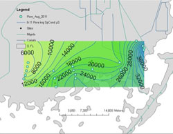
 Spatial variation in soil porewater salinity in the southeastern Everglades ecotone at 30cm soil depth in August 2011.
Project Collaborators
Christopher Madden, Stephen Kelly, David Rudnick, Donatto Suratt, Eveyln Gaiser, Jennifer Richards
Funding sources
South Florida Water Management District
Everglades National Park
Contact Tiffany Troxler for recent project reports

