Background
River deltas are depositional environments in the coastal landscape that provide critical ecological and socio-economic services, protecting and supporting the livelihood of a disproportionate percentage of the world’s population. Rivers drain 87% of global landmass and due to their location at the confluence of rivers and the ocean, deltas are uniquely situated to be productive and biogeochemically important ecosystems in the coastal zone. However, many of the world’s active deltaic floodplains are threatened and unsustainable because reduced sediment availability relative to subsidence and sea level rise, results in wetlands drowning under rising seas. Delta-X studies the vulnerability of coastal deltaic wetlands to sea level rise and reduced sediment input in the Mississippi River Delta (MRD) in coastal Louisiana. The MRD represents 40% of the coastal wetlands in the conterminous United States, but has lost ~5000 km2 of wetlands and the ecosystem services they provide since the 1932 due to human activities. Upstream dams have significantly reduced (64%) the sediment load to the Louisiana coast and river engineering has decreased natural overbank flooding and sediment retention, functionally replicating an abandoned delta.
Wetland vegetation (above- and belowground) contributes to soil accretion directly through organic matter production. In particular, belowground root production and the concentration of refractory organic matter in dead roots are often the most significant factors in controlling organic carbon storage and soil formation in coastal wetlands. Vegetation also contributes indirectly to accretion by slowing flow, thereby promoting trapping and deposition of mineral sediments delivered by the distributary channel network. These processes acting together at different spatiotemporal scales allow wetlands to keep pace with sea level rise. One promising approach to delta restoration is to allow river re-occupation to transform coastal basins from inactive to active deltas, thereby increasing vegetation productivity and sediment accretion. The Delta-X campaigns will provide crucial remote sensing and in situ observations of the high frequency processes governing delta evolution across different areas in the MRD. This information will be used to improve state-of-the-art models to assess the vulnerability and resilience of coastal wetlands and deltas to sea level rise. Delta-X is an interdisciplinary project including radar scientists, hydrologists, geomorphologists, and ecologists, funded by JPL-NASA (https://deltax.jpl.nasa.gov/science/team/).
Research Objectives
Due to a lack of understanding of how vegetation interacts with abiotic conditions across the coastal landscape, we lack a clear understanding of how vegetation dynamics (e.g., root:shoot ratios) and species zonation are likely to be influenced by changing ecosystems and climate change across deltaic basins. We have identified 7 sites spanning the active Atchafalaya-Wax Lake Delta complex and the abandoned Terrebonne Basin in coastal Louisiana to quantify vegetation dynamics (above- and belowground biomass and productivity) and soil properties (e.g., bulk density, nutrient content) across multiple hydrogeomorphic zones (i.e., subtidal, low- and high intertidal, and supratidal). Our study design will allow us to compare basins and identify trends along a vegetation and salinity gradient. Furthermore, Delta-X provides the platform to model sediment accretion based on sediment availability and vegetation dynamics and to use remote sensing to identify indicators of ecosystem vulnerability across multiple coastal basins and environmental settings.
Delta-X uses NASA airborne remote sensing assets to calibrate and validate hydrodynamic and ecogeomorphic models to quantify the mesoscale (i.e., on the order of 1 ha) patterns of soil accretion that control land loss and gain, and to predict the resilience of deltaic floodplains under projected relative sea level rise. The remote sensing platforms include two radar instruments (UAVSAR and AirSWOT) to measure the hydrological parameters and one imaging spectrometer (AVIRIS-NG) to estimate plant productivity and water quality. Two Delta-X airborne and in situ campaigns in 2021 (Spring and Fall) will be executed by a multi-disciplinary team of researchers encompassing experts in hydrology, sedimentology, geomorphology, and ecology. A final in-situ-only campaign dedicated to model validation will be executed by a reduced team in 2023.
Study Area
Location: Mississippi River Delta, USA
Study sites: Atchafalaya and Terrebonne Basins in southeastern Louisiana
Project Collaborators
Marc Simard, Cathleen Jones, Judy Lai-Norling, Ian McCubbin, Sara Flores, Robert Twilley, Tamlin Pavelsky, Ernesto Rodriguez, Liviu, Giosan, Michael Lamb, Sergio Fagherazzi, Paola Passalacqua, Cedric Fichot, David Thompson
Science Team: https://deltax.jpl.nasa.gov/science/team/
Funding sources
Jet Propulsion Laboratory – NASA
Contact Edward Castaneda (ecastane@fiu.edu) for more information about the project.
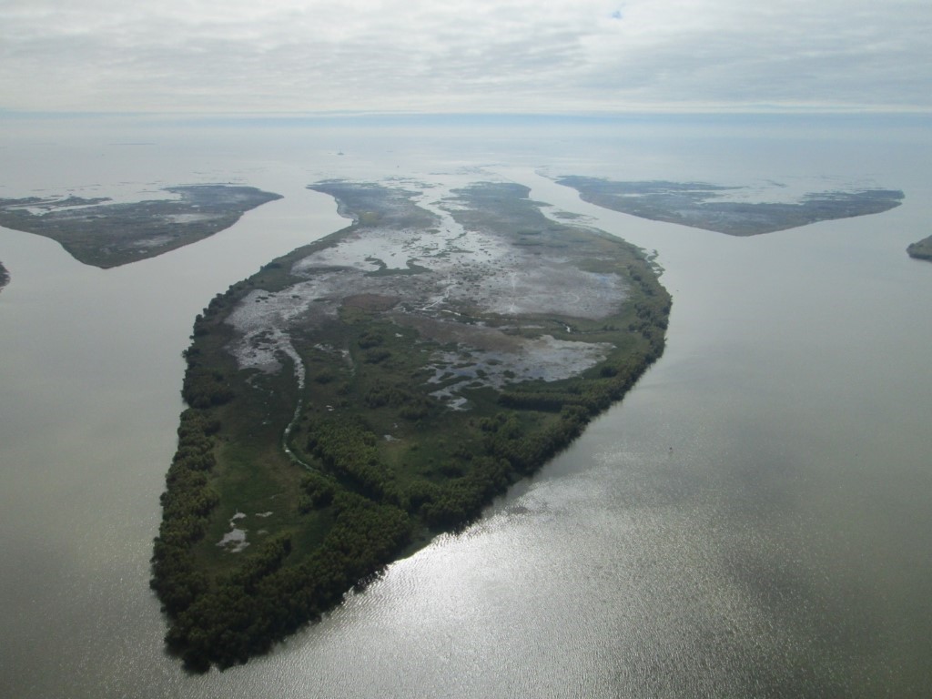
Figure 1. Aerial view of Mike Island, Wax Lake Delta in southeastern coastal Louisiana.
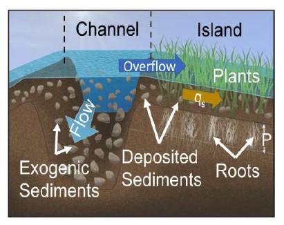
Figure 2. Schematic representation of processes that influence soil accretion in coastal deltaic wetlands: 1) trapping and deposition of mineral sediments delivered by the distributary channel network at a rate qs, and 2) accumulation of organic matter (P) generated by local plant growth (roots and litter).
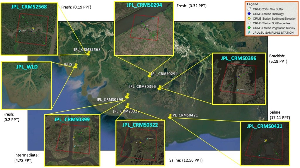
Figure 3. Delta-X study sites adjacent to the Coastwide Reference Monitoring System (CRMS) across the Atchafalaya and Terrebonne basins in coastal Louisiana. The Wax Lake Delta (WLD) site is not part of CRMS. Each site is labeled with its salinity class (Fresh, Intermediate, Brackish, Saline) and the mean salinity from 2007- 2019.
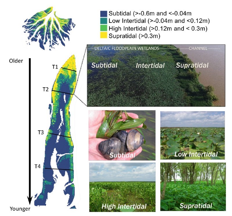
Figure 4. Illustration of deltaic island cross-sectional elevation profile morphology from four transects across Mike Island at WLD and classification of hydrogeomorphic zones (subtidal, low- and high intertidal, and supratidal) based on elevation. Differences in morphology and elevation range are related to island age, with younger areas (lower elevation) at the distal portions of the delta, and oldest islands with high overall elevation at the delta apex (Bevington and Twilley 2018; Twilley et al. 2019).
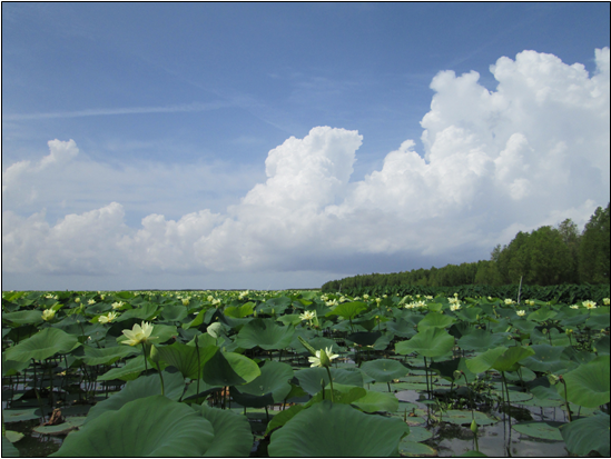
Figure 5. Vegetation zonation in Wax Lake Delta, southeastern Louisiana.